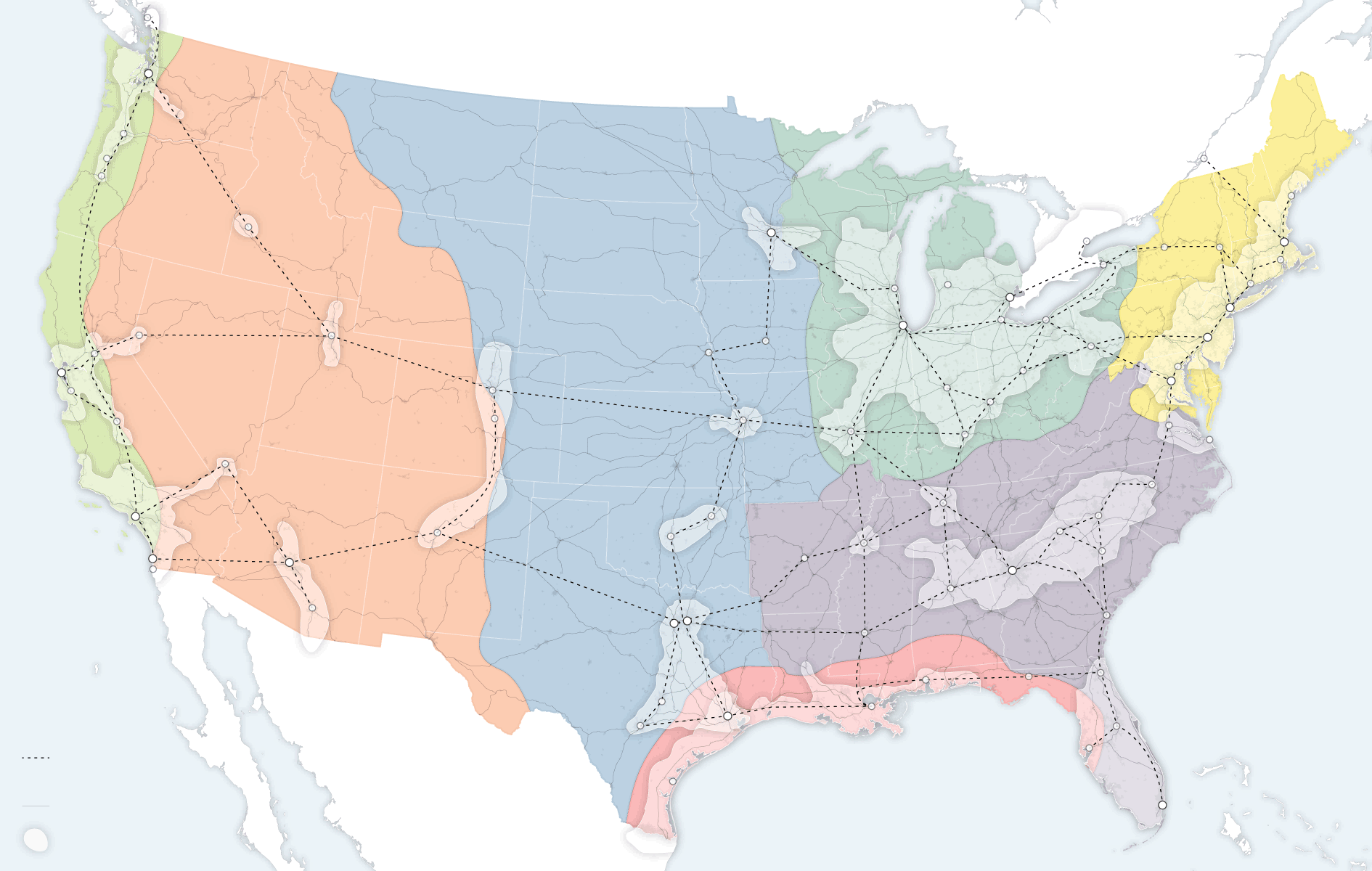
At the international level, America’s diplomatic, intelligence and military agencies study trends in the international environment that will shape our world in the decades ahead. But at the national level, there are mega-trends that will shape America at least through mid-century. One need only look at a map – a new map of the United States to see that socially and economically, America is reorganizing itself around regional infrastructure lines and metropolitan clusters that ignore state and even national borders.
Advanced economies in Western Europe and Asia are reorienting themselves around robust urban clusters of advanced industry. America is already headed toward a metropolis-first arrangement. The states aren’t about to go away, but economically and socially, the country is drifting toward looser metropolitan and regional formations, anchored by the great cities and urban archipelagos that already lead global economic circuits.
The Northeastern megalopolis, stretching from Boston to Washington, contains more than 50 million people and represents 20 percent of America’s gross domestic product. Greater Los Angeles accounts for more than 10 percent of G.D.P. These city-states matter far more than most American states — and connectivity to these urban clusters determines Americans’ long-term economic viability far more than which state they reside in.
This reshuffling has profound economic consequences. America is increasingly divided not between red states and blue states, but between connected hubs and disconnected backwaters. You can see where this is all going – just look at a map.